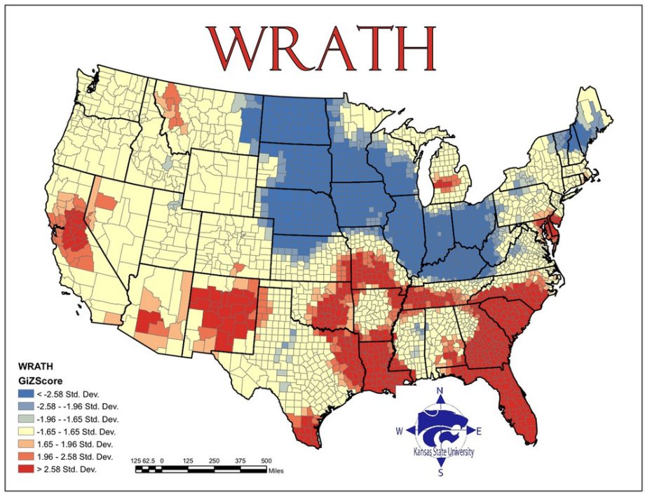
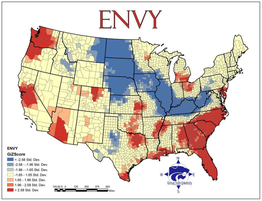
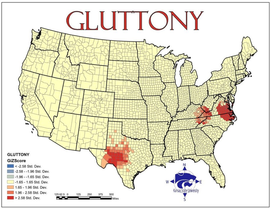
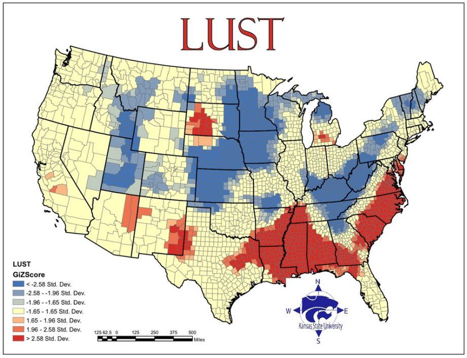
Maps of Seven Deadly Sins in America
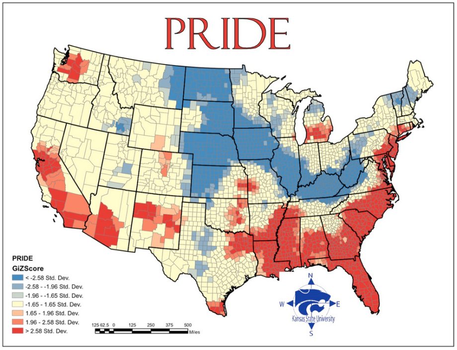
Geographers from Kansas State University have created a map of the spatial distribution of the Seven Deadly Sins across the United States. How? By mapping demographic data related to each of the Sins.
Below are screenshots of the maps in standard deviation units; red naturally is more sinful, blue less sinful.
You may also like these unbelievable pictures of the world’s “Synthol men”.